


Laplair
Forest Lakes
Property consists of several land titles, all freehold.
Total area including lakes and ponds; 62 Thai Rai. This equals 24 Acres or 10 Hectares.
The land is developed and suitable for a resort, a vocational camp, and can be developed for a variety of uses; elderly persons home, educational weekend camp, fishing venue, or resort.
Its isolated position is ideal for those wanting to get away from the metropolitan rush. Positioned just off Highway 323, Kanchanaburi - Thong Pah Phum at km.
Laplair
Forest Lakes


Map 1
Map 2
Map 3
Laplair Maps
MAP 1 is taken from a land survey map, 2012 when the land was finalized to the current owners.
MAP 2 is taken from the same survey, as Map 1.
MAP 3 is Google Maps, and shows the 169 mile route from Kanchaburi (largest big city) to Hin Dat (local village).
MAP 4 is Google Maps, showing the route from Bangkok to Hin Dat. 313 Miles
(By the by; the highway is fast and open with little traffic)
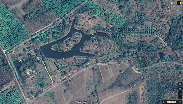
MAP 5 is taken from Google Earth (2020) and shows the land on a satellite photograph. The main house is shown with a red cross and the small huts with yellow crosses.
Other sleeping quarters are marked with green crosses.
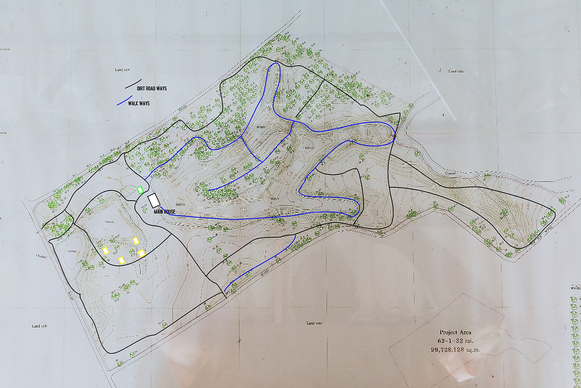
MAP 6 is Map 1 with houses and road ways added.
(See below)


Map 4
Map 5
X
X
X
X
X
X
X
The web address below will open the correct satellite map on Google Maps. Activate the satellite mode.
Map 6
About 230 meters
About 440 meters
Laplair
Statistics
LAND
62+ Rai of land = 24+ Acres
Distance along property road ways (inside perimete fence) is about 2km., or 6500ft., or 1.24 miles.
Depth of main lake at deepest point is 7m or 23ft.
Length of island is about 80m., or 260 ft.
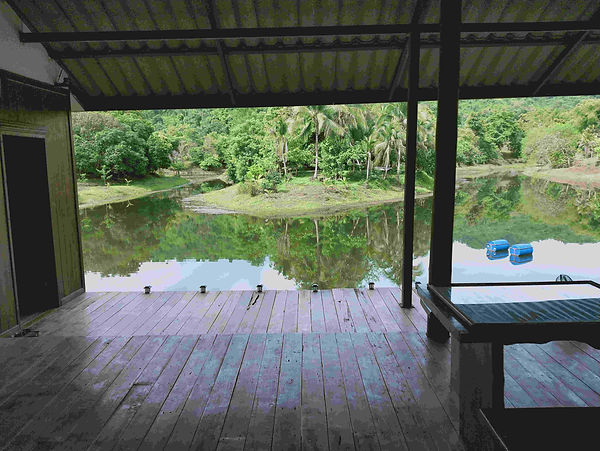
MAIN HOUSE
Living room, Bedroom, Kitchen, Deck, and Bathroom.
LIVING ROOM 15ft x 23ft - 4.5m X 7m
KITCHEN 33ft x 10ft - 10m X 3m
BEDROOM 23ft x 23ft - 7m X 7m
BATHROOM 16ft x 8ft - 5m X 2.5m
DECK 13m x 10m, less corrner 3m x 5m
DECK 43ft x 33ft, less corrner 10ft x 16.5ft

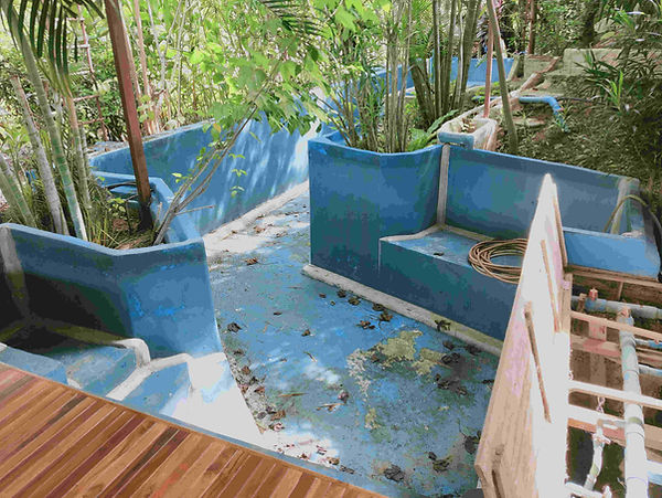
Concrete swimming pool.
2m/3m wide and 12m long, in an 'L' shape.
Leaks somewhere